Africa, a continent grappling with immense water challenges, is on the cusp of a hydrological revolution, thanks to the transformative power of satellite technology. For decades, understanding and managing water resources across the vast and diverse African landscape has been a formidable task. Limited ground-based data, coupled with the sheer scale of the continent, often meant that water management strategies were reactive rather than proactive, leaving communities vulnerable to droughts, floods, and dwindling supplies. However, a new era of water governance is dawning, driven by sophisticated satellite-based digital tools that are painting an unprecedentedly detailed picture of Africa's water story.
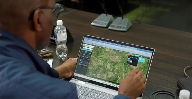
These advanced technologies are moving beyond simple visual observation. They are employing a range of sensors and analytical techniques to monitor crucial hydrological indicators with remarkable precision. Satellites equipped with radar altimeters can measure the water levels of lakes and reservoirs, even in remote or inaccessible areas. Thermal imaging can detect changes in surface water temperature, offering insights into evaporation rates and the health of aquatic ecosystems. Gravimetry satellites can map variations in groundwater storage, a critical but often invisible resource. Furthermore, sophisticated algorithms are now capable of analyzing vast datasets to identify patterns of water flow, predict river levels, and even assess the operational efficiency of dams.
The implications of this newfound clarity are profound. For water security, the benefits are manifold. Governments and water managers can now make more informed decisions about water allocation, infrastructure development, and drought preparedness. Early warning systems for floods and water scarcity can be enhanced, allowing for timely interventions that save lives and protect livelihoods. Farmers can receive more accurate information about soil moisture and rainfall, enabling them to optimize irrigation and crop yields, thus bolstering food security. The impact extends to environmental management as well, with scientists able to track the health of wetlands, monitor deforestation's effect on water catchments, and assess the impact of climate change on water availability.
Researchers like Nancy Wayua, working on Lake Sulunga in Tanzania, are at the forefront of this data-driven transformation. By analyzing decades of satellite imagery, she can meticulously trace the historical fluctuations of the lake, understanding the environmental and human factors that have contributed to its changes. This historical perspective, combined with real-time data, provides a powerful tool for predicting future trends and developing sustainable management plans. The story of Africa's water is no longer a narrative of uncertainty and scarcity; it is becoming a story of informed stewardship, powered by the watchful eyes of satellites and the ingenuity of those who interpret their gaze. This technological leap offers a beacon of hope for a continent striving to ensure water security for its growing population and its invaluable ecosystems.
How satellites are rewriting Africa’s water story
Admin
Apr 13, 2026
1 Views
3 min read
Source:
The Independent Uganda